Honey Hollow Watershed – Articles and Pictures
- Inventory in the Media
- Climate Change at Honey Hollow
- Hydrogeology of Honey Hollow
- The Dirt on Soil!
- Wanted: A Few Good Spring Birds!
Putting Nature into a Computer – How an online tool is helping track an inventory of wild things
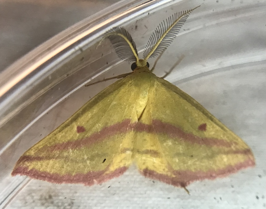
The Natural Resource Inventory of the Honey Hollow Watershed – a project that celebrates and revisits the 50 year-old 1972 census – is well underway on the property of the Bucks County Audubon Nature Center at 2877 Creamery Road in Solebury Township. Eighteen “observers” have already submitted almost 2,500 observations of 924 species of plants and animals found on Bucks Audubon’s property within the watershed. These observation have ranged from the common and expected like Blue Jays, White-footed Mice and Red Maples to the little known or unexpected like the Bold Jumping Spider, the Splitgill Mushroom and the Wavy-lined Emerald Moth. We’re also being amazed by the sheer number and variety of certain groups – moths and butterflies, for example. Participants have already identified 111 species!
How do we record and track these sightings and manage the data that are being collected? We use iNaturalist a free, online tool available at https://www.inaturalist.org/ iNaturalist describes itself as “an online social network of people sharing biodiversity information to help each other learn about nature,” with its primary goal being to connect people to nature. Used by research biologists, citizen scientists, curious backyard observers and everyone in between, the database and social network allows anyone to teach and learn about biodiversity anywhere on Earth. Set up an account, take and submit a picture with your smartphone and start learning and exploring. Remember, you don’t need to know the identity of the animal or plant you’ve photographed. Submit the picture and iNaturalist will help you find out what it is. Its ease of use makes it the ideal tool for Honey Hollow Watershed – Revisited as we work to find out exactly what plants and animals exist within the watershed.
To explore the project and sign up for iNaturalist, take the following steps: Go to the website above and click on “Community” and then “Projects” on the dropdown menu. In the Search box type “Honey Hollow Watershed Natural Resource Inventory.” Click on the link and start exploring. Keep up with the growing inventory of plants and animals reported to be living in the watershed and sharing this region with all of us.
While the project will engage the expertise of professional biologists, much of the data has and will continue to come from interested, community members like you. We encourage everyone to create a free iNaturalist account and submit what he or she sees on the property. Most observations will need to be confirmed but that simply entails the verification of your identification of a species by another observer in person or of your photograph on the website. In the case of birds – not always easily photographed – eBird users can submit their observations to the Cornell Lab or Ornithology website https://ebird.org/home.
The average temperature in Bucks County between 1967 and 1972 was 50.72 degrees F. Between 2016 and 2021, it was 54.4 degrees – an increase of 3.68 degrees. This is a major increase over a relatively short period of time and it’s statistically highly significant. This means that average temperatures we are now experiencing are similar to those experienced in Baltimore 50 years ago. Our averages from those good old days are now the norm in Cleveland and Hartford. Our average high and low temperatures – 61.15 degrees and 40.26 degrees in 1967-1972, 64.43 degrees and 44.35 degrees in 2016-2021 – reflect a similar trend.
While our average, annual precipitation has increased over these same time periods from 45.85 inches to 50.47 inches, this increase is not statistically significant because snow and rain events have always been highly variable year to year. However, what has changed significantly is the frequency of severe weather events. The amount of our yearly precipitation that comes in intense single-day events has risen steadily during the last several decades. These events have a major impact on our daily lives, our communities and the natural world. For more on this, see: https://www.epa.gov/climate-indicators/weather-climate.
In thinking about these statistics, it’s important to keep the concept of “50 years” in perspective. While it seems like a huge amount of time, a lifetime, since my sister was married, those 50 years are a tiny blip by Earth history standards and that’s a lot of change for such a miniscule jot of time. Virtually every element of the world we live in is impacted in some way by these changes. People react and take appropriate steps to cope in the best ways possible. The natural world does the same thing – earlier migration, altering food sources, evolving a lighter coat and better heat tolerance, etc. Those who succeed survive and those who don’t, languish or disappear.
As Bucks County Audubon conducts the biological inventory at Honey Hollow, we are looking for the reaction to these climate changes in our local environment. Which of our flora and fauna are adapting, evolving and surviving? Which are not? Watch here for future articles that identify and explain the impacts we discover.
Sally Conyne, June 2022
The Honey Hollow Watershed is a relatively small drainage basin which flows into and is thus part of the Aquetong Creek Watershed. The Aquetong Creek Watershed drains a large portion of central Solebury Township and feeds into the Delaware River.
The Honey Hollow Watershed lies within the “Gettysburg-Newark Lowland Section” of the “Piedmont Physiographic Province.” The Lowland Section extends through Southeastern Pennsylvania from Gettysburg to Newark, New Jersey. The Lowland Section consists of rolling lowlands, shallow valleys, and isolated hills.
The Honey Hollow Watershed is a classic funnel-shaped watershed. The topography, and thus the configuration of the watershed, was created through differential weathering of a variety of underlying rocks. The upper headwaters of the Honey Hollow Watershed, located north of Old York Road (Route 263), contain bedrock, which is relatively harder to decompose than rocks found in the lower portion of the watershed to the south near Meetinghouse Road. The watershed has a total relief of 280 feet; ranging from 430 feet of elevation on the north edge of the watershed divide to 150 feet elevation at the southern mouth of the watershed. Slopes are steepest in the central portion of the watershed, south of Old York Road (Route 263), where they average 10 percent.
The geology of the Honey Hollow Watershed varies from north to south (Figure xxx). The oldest rocks in the watershed are in the south region and were formed during the “Cambrian Period” about 510 million years ago. Those rocks are classified as the “Allentown Formation.” Allentown Formation rocks consist of “dolostone” a calcium-magnesium carbonate rock similar to limestone. The rocks formed from sediments originally deposited as limy mud and sand in warm, shallow seas that once covered the eastern United States. Very little life existed when these rocks were deposited and generally, only the fossils of “stromatolites” can be found in the rocks. Stromatolites are cyano-bacteria which create bio-film mats that trap carbonate mud and look in cross section somewhat like a cabbage when sliced in half. The Allentown Formation carbonate rocks are readily dissolved by the acidic precipitation which seeps into the ground. The Allentown Formation generally weathers to create broad lowlands with thick clay soils. The soils are remnants of the clay which has remained after the carbonate portion of the rock dissolves. Small cavernous conduits can dissolve as water passes through the rock. These voids provide good groundwater storage and flow but can also allow sinkholes to form in the thick clay soils.
Immediately north of the Allentown Formation are found the “Beekmantown Group” rocks (Figure xxx). These rocks were formed during the lower to middle “Ordovician Period” (485 to 460 million years ago) and are of similar composition as the Allentown Formation, being a “dolostone.” The Beekmantown Group of rocks; being of similar rock composition as the Allentown Formation, also weather to form broad lowlands with thick clay soils and voids in bedrock which conduct groundwater flow.
The central and northern upland portion of the Honey Hollow Watershed contain an entirely different form of rock than the southern carbonate region. The upland rocks are of the “Stockton Formation” and were deposited in the late “Triassic Period” about 237 to 207 million years ago. These rocks formed when the continent of Africa separated from North America to create a rift valley or crack which extended from North Carolina to Newfoundland that filled with sediments. The Stockton Formation was formed by the transport of sands and quartz pebbles deposited by streams that flowed north from former mountains in the Philadelphia area. The rocks are described as arkoses; being poorly sorted sands which were present in former stream channels. Siltstones and mudstones also exist in the Stockton Formation rocks and were likely formed from silt and mud that accumulated on the floodplains of the ancient streams. During the Triassic Period when the rocks were formed, plants existed and dinosaurs were just starting to evolve, but neither of their fossils are generally found. This is because anything which died in or near the streams would have been degraded by the actions of the waters as well as been decayed by oxygen, since the sediments were not well submerged beneath water. The Stockton Formation sandstone rocks weather physically as the sand grains separate from the poorly cemented rock matrix to release the original sand, silt, and clay particles. This weathered stone results in a variety of sandy to silty soils. Because the rocks breakdown relatively more slowly than the carbonate rocks to the south, the Stockton Formation sandstones create the steeper sloped upland area in the watershed.
Within the Stockton Formation is a rock member referred to as a “quartz conglomerate.” This is found as two layers traversing the north portion of the Honey Hollow Watershed (Figure xxx). The rock is seen as boulders in the stream channel north of the Bucks County Audubon Society Visitor Center. The conglomeritic rock consists of quartz pebbles in a poorly sorted arkosic sandstone. The rock was formed from the accumulation of pebbles and sands in stream channels that carried quartz rocks which had eroded from former mountains in the Philadelphia area that contained quartz in their formations. The conglomerate is the most resistant rock in the watershed and forms the subtle ridgetop along which Old York Road (Route 263) follows. The quartz conglomerate results in a form of a dam which holds water in the headwaters before allowing it to spill out as numerous springs and seeps onto the more steeply sloped hillsides immediately to the south.
In summary, the geology of the Honey Hollow Watershed is composed of three general hydrogeologic regions within the watershed: 1) An upland headwater area north of Old York Road (Route 263) which is relatively flat and contains well drained sandy soils that readily absorb precipitation, allowing waters to soak into the underlying sandstone aquifer which provides good groundwater storage; 2) A steeply sloped area in the central portion of the watershed where groundwater from the uplands discharges through springs and seeps from the sandstone aquifer to provide a consistent supply of streamflow, even during dry periods. This is also the region where runoff from the uplands area flows down the steep slopes to erode the sandy to silty soils; and 3) A relatively flat lowland area in the south portion of the watershed where runoff and precipitation are able to soak into the underlying very permeable carbonate aquifer system, which slowly releases groundwater at the mouth of the watershed. The ability of these carbonate rocks to store and release waters gradually as stream baseflow provides a consistent and high-quality supply of water to feed the downstream Aquetong Creek system.
….. and on top of Honey Hollow’s ancient geology is its brown gold – its soil. Part of the soil is actually born of that geological layer or bedrock immediately beneath the soil. When, over millions of years, that rock is worn and weathered, particles are formed that then mix with water, air and a variety of micro-organisms and other organics resulting in the basic element we call “soil.” The rock particles are classified according to their sizes from sand (the coarsest) to silt (next in size) to clay (the finest). This sizing plus the percentage of each of the other elements are the basis for the classification of a soil as one of thousands of named types. Each of these soil types has its own characteristics – productivity, drainage or water retention, erodibility, etc. In the Honey Hollow Watershed alone, 22 types have been mapped.
In one sense, the farmers of Honey Hollow were too successful because they were blessed with rich, productive soil. The farmers’ productivity gave them the financial ability to adopt modern, heavy machinery in the first decades of the 20th century. When they expanded their cultivation into areas not previously used, they accelerated erosion and the general depletion of the soil. They saw many tons of valuable topsoil from the higher reaches of the watershed deposited as water-logged soil up to three feet deep in the 7-acre marsh in the lower area of the watershed just west of Creamery Road. This was the motivation for their request for help and advice from the U.S. Soil Conservation Service in the late 1930’s.
The first step in making a soil conservation plan was and is to determine the types of soil at a site. The second is to consider the topography of the land and, so, the conditions in which the soils lie. Finally, the third step is to determine the amount of soil, in a useful state, that remains at spots around the site.
The Conservation Service classified the soils found in the Honey Hollow Watershed into five groups, each with its own strengths and challenges:
- Steep slopes greater than 15%, moderately deep (20+ inches to bedrock), well drained. Slope limits any use.
- Slopes less than 15%, deep (36+ inches to bedrock), poorly to very poorly drained floodplain. Wetness limits use to wetland habitat and wildlife, ponds
- Slopes less than 15%, deep (36+inches to bedrock), moderately well drained soils with some water retention issues during wettest months. Best suited to summer crops, hayfields and pasture
- Slopes less than 15%, deep (36+inches to bedrock), well drained soils. Well suited for crops, pasture and woodland.
- Slopes between 3% and 15%, moderately deep (18 to 36 inches to bedrock), well drained soils. Well suited to crops, pasture and woodland with consideration given to slope and soil depth.
Mitigation measures addressing the erosion and other problems that were occurring in each of these groups were designed and implemented. They including contour farming, diversion terraces and ditches, strip cropping and crop rotation, tree and bush planting, pond building and dam construction. The farmers soon saw, literally, the fruits and other products of their labor. For the next 30 or more years, the site was used to educate others about these novel approaches, most of which are now standard practices. The farming in the watershed today continues to employ these basic conservation strategies while the current stewards of the land have added some new approaches in recognition of recent discoveries.
Scientists have begun to recognize the vital importance of a vibrant community of microscopic organisms in the soil that works in symbiotic relationships with the roots of plants. The organisms help transmit nutrients into plants and can even transport nutrients between plants. We are only just beginning to understand the complexity and importance of this “root microbiome.” These discoveries have elevated the importance of avoiding the use of pesticides. Cover crop planting and rotational crop and pasture management also improve soil health.
“No till” farming and other methods of allowing precipitation to be filtered by soils and become clean groundwater are now regularly used to further decrease erosion and improve our water supply.
Finally, today’s Internet provides access to a vast amount of resource material to anyone interested in soils, geology or hydrology. The USDA and Natural Resources Conservation Service (NRCS) have compiled a “Web Soil Survey” (WSS) which the public may use to access the latest soil information as well as generate maps showing soil distribution.
The United States Geologic Survey (USGS) has incorporated the soil information with geologic and surface water flow data to create a web-based interactive “National Water Information System: Mapper” to offer the public ready access to hydrogeologic information for whatever watershed size they desire.
Stay tuned for the next installment of the natural history of Honey Hollow: Climate and Water.

As a part of the Inventory of the Biological Resources of Honey Hollow, we’re looking at the birds that occur here throughout the year and comparing those species to the species that lived and visited the site 50 years ago. Some of these species migrate through the area and are only seen in spring and fall. Others leave for the winter but return to breed and nest. Here’s a list of species that occurred here historically but have not been seen during the last few years. Some are surely present but simply haven’t been noticed. Some species are rare or highly irregular, but others may no longer live in or visit this area. We want to know.
- Black-billed Cuckoo
- Common Nighthawk
- Eastern Whip-poor-will
- Spotted Sandpiper
- American Bittern
- Olive-sided Flycatcher
- Acadian, Yellow-bellied and Least
- Flycatchers
- White-eyed, Philadelphia and Yellow-
- throated Vireos
- Purple Martin
- Bank Swallow
- Cliff Swallow
- Gray-cheeked and Swainson’s Thrushes
- Grasshopper and Vesper Sparrows
- Yellow-breasted Chat
- Bobolink
- Rusty Blackbird
- Northern Waterthrush
- Summer Tanager
- Blue Grosbeak
- Dickcissel
- Warblers -Worm-eating, Golden-winged, Prothonotary, Orange-crowned, Connecticut, Mourning, Kentucky, Hooded, Cape May, Cerulean, Bay-breasted, Blackpoll, Yellow-throated and Prairie
Please come by and do some bird searching and watching. Keep your eyes on the sky. And then let us know what you see. Report your observations to eBird or send us an email. We thank you and the birds thank you.
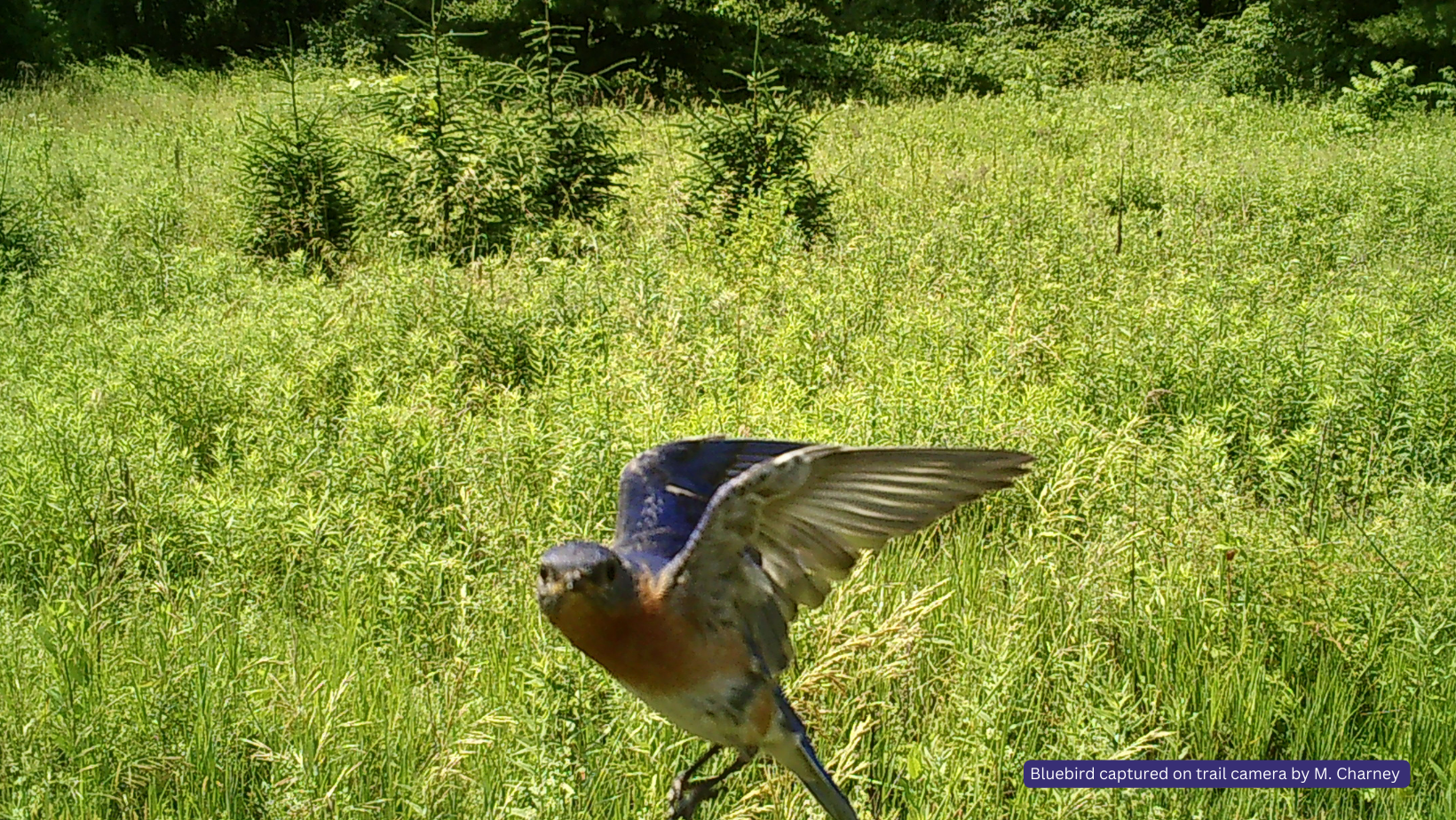
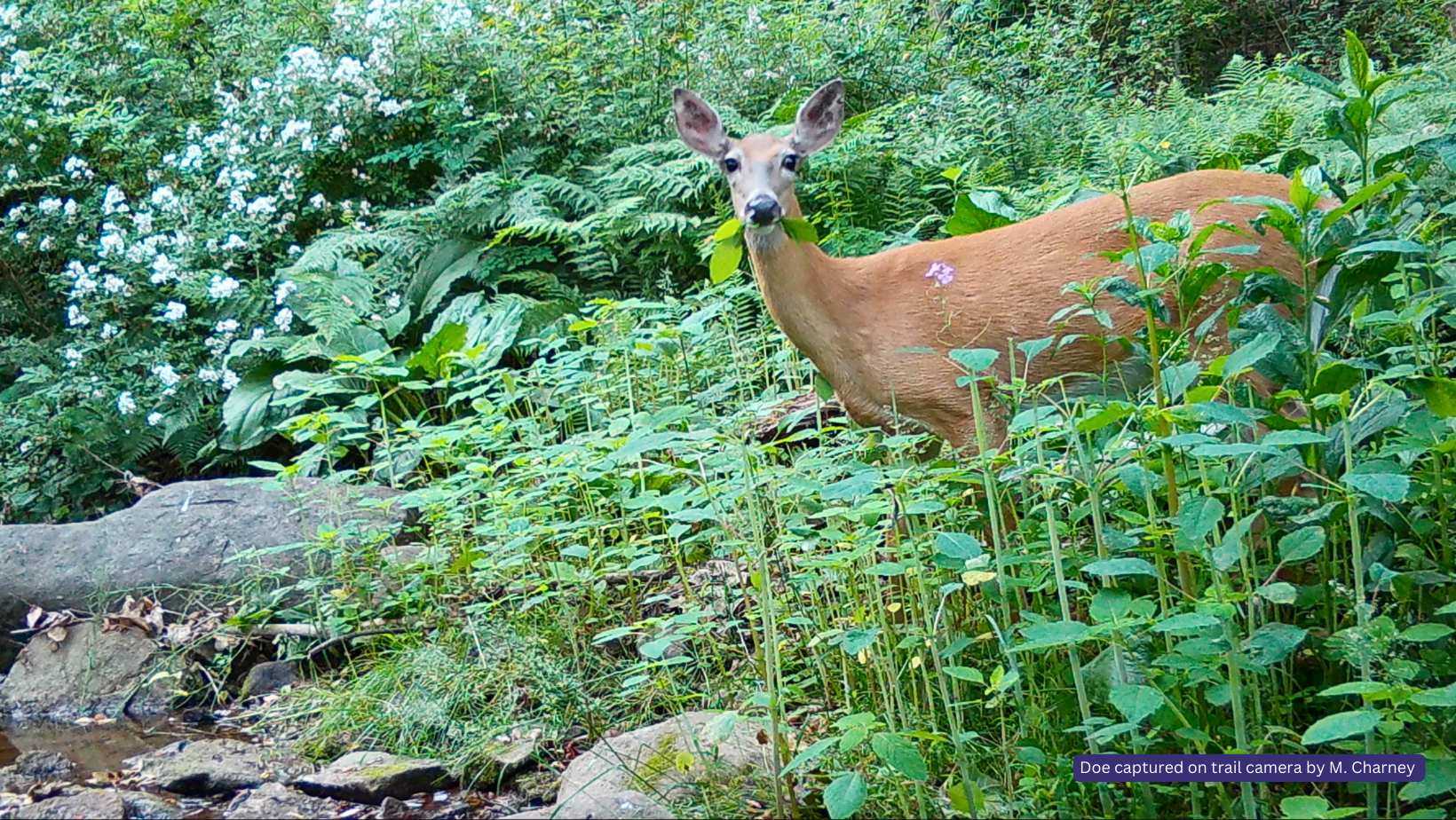
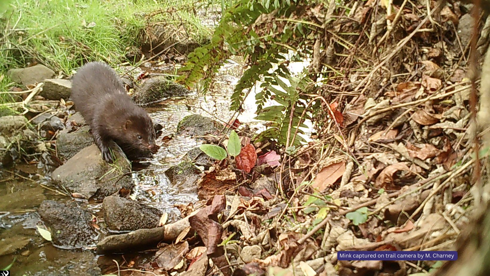
Great Blue Heron captured on field camera
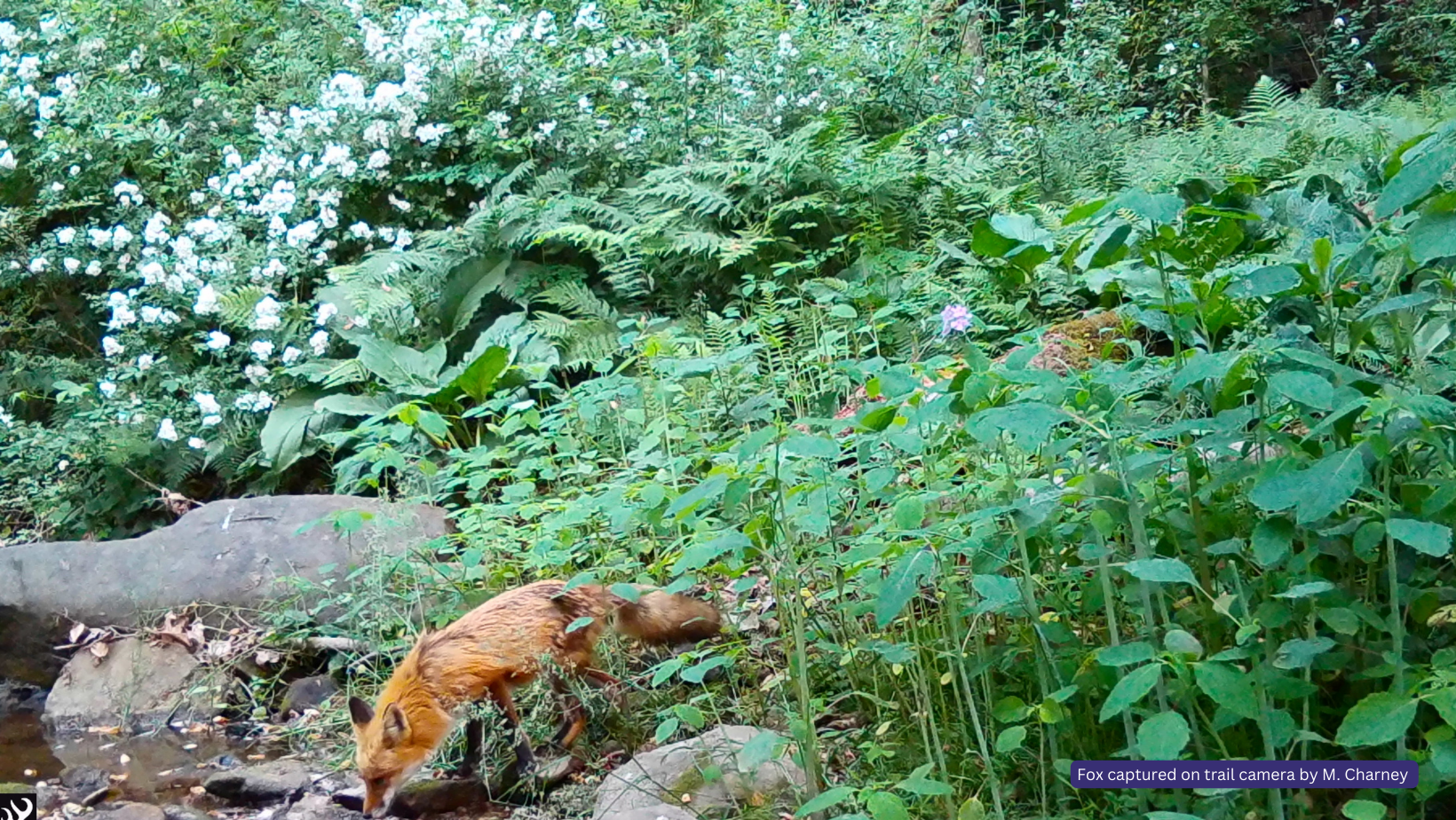
Red Fox captured on field camera
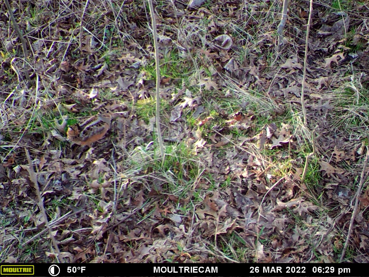
American Woodcock captured on field camera

Brown Thrasher by Debbie McKenzie
